Henry Shu
GIS/Street View Integration
This work is in collaboration with Cheng-Yang Chen (陳正揚) of Chunghua Telecom. This project aims to overylay geographical information (GI), which includes roads, buildings, place names, etc., onto user-captured images or videos to guide the user in an unfamiliar place. Figure 1 below depicts our system.
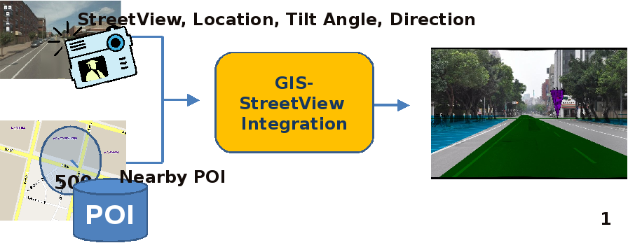
Figure 1.
The overlaying is done dynamically, taking into account the perspective as viewed by the user. Therefore, objects that appear far from (close to) the user will realistically be rendered as so. In the following panoramic demo, pay attention to how the relative positions of the building names change as the user rotates. (Light brown represents buildings and yellow represents roads.)
The panoramic demo is realized by calculating the user perspective on the fly. Figure 2 below depicts how it works.
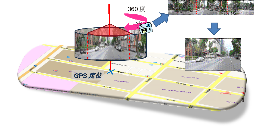
Figure 2.
Below is a video showing the result of using our GIS system with a GPS device and a low-res cam. It was done at 15fps. The yellow track constitues the positions as recorded from the GPS and the green tracks are roads.